
Advancements on the development of EPIPELAGIC platform and EPIPELAGIC WebGIS App:
A key element of EPIPELAGIC project, is the development of a WebGIS APP as a Progressive Web Application (PWA). PWA apps take advantage of the enhanced capabilities of modern Internet browsers (e.g. HTML5, Javascript) and have significant benefits, such as a) support progressive display on systems with different speed / network capabilities based on the principles of progressive improvement, b) are “hybrid” (mobile / web) applications that can run either on web browsers or on mobile phones (similar to native mobile applications) and c) can also run offline, thanks to “service workers” (scripts that are executed in the background on the browser).
The EPIPELAGIC main menu currently has three major features, namely the “Add Sat Image”, “Add Product” and “Change Monitoring” options. Through the WebGIS APP the end user can display a) pre-processed remote sensing data from various satellites as layers using the “Add Sat Image” option, b) display products “Add Product” which were computed for the EPIPELAGIC project, like land classification estimations from the U-NET algorithm or processed Corine Land Cover layers.
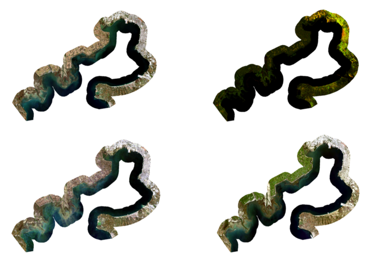
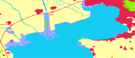
Satellite images (a) Sentinel 2 L2A (b) Sentinel 1 GRD (c) Landsat 5 (d) Landsat 8 and (e) pre-processed Corine Land Cover product into five classes (Artificial, Agriculture, Forest, Wetlands, Water)
Furthermore, the “Change Monitoring” option allows the end users to visualise changes “on the fly” from the products list for specific classes (Artificial, Agriculture, Forests, Wetlands and Water). Some examples are shown below.
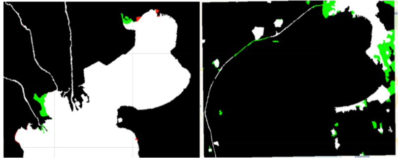
Change Difference for Corine (CLC) between years 1990 and 2006 for (a) Artificial Surfaces and (b) Water. Green indicates gain (regions that have the label in 2006 but not in 1990). Red indicates loss (regions that have the label in 1990 but not in 2006). White indicates regions that kept this label, while Black are regions with other labels.
Reference:
The application was built by extending an already available open source web-gis viewer (https://github.com/bmcbride/gps-map).